
Download the PDF guide
You can read this guide on the page. No form is required. If you want a PDF copy to keep or share, the download asks for your name and email.
Read the full Michael Way guide-blog
Straight answers to the questions people ask most: the drive to Nellis and Creech, home values, HOA and SID/LID fees, schools, crime-data lookups, summer bills, and Eric’s own take.
Where it is
This outline shows how Michael Way sits in the Las Vegas Valley.
Map data © OpenStreetMap contributors. The outline is for orientation only and is not a survey or legal boundary.
Neighborhood tour
Watch a neighborhood tour of Michael Way.
New Construction Nearby
Michael Way is a largely built-out neighborhood, and no active new-home community was found in or right next to it.
Builder info changes often; ask Eric for current incentives.
Mixed housing, bus lines and quick freeway access between Rancho Drive and Rainbow Boulevard.
Northwest Las Vegas · Central, close-in and affordable
At a glance
| Fact | Detail |
|---|---|
| Typical home value | $352K |
| 1-year change | -2.2% |
| Price range (tiers) | $255K–$417K |
| To Nellis AFB | 25 min |
| To Creech AFB | 45 min |
| To the Strip | 17 min |
| To the airport | 23 min |
| BAH O-3 w/ deps | $2,382/mo |
Overview
Michael Way is a close-in northwest Las Vegas neighborhood named for the residential street that runs through it, roughly between Rancho Drive and Rainbow Boulevard around Lake Mead Boulevard and Smoke Ranch Road in ZIP 89108.
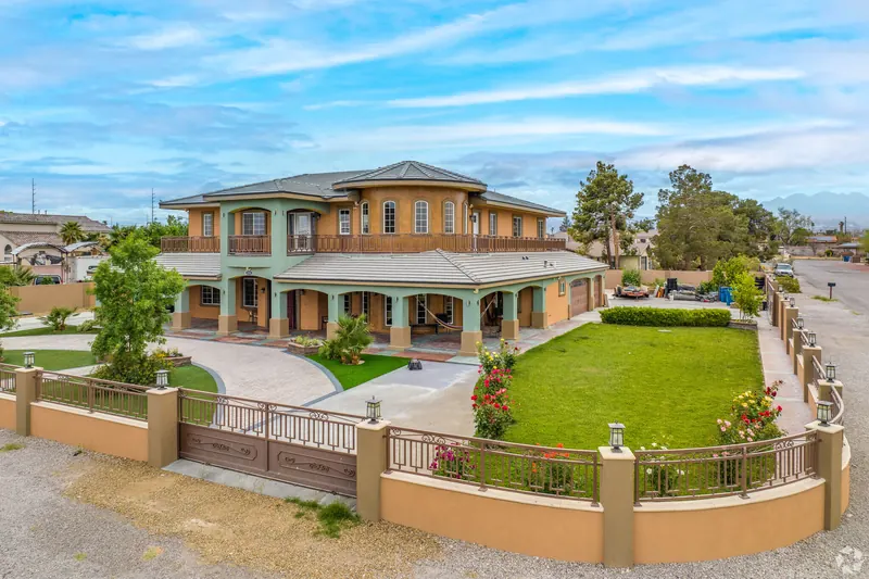
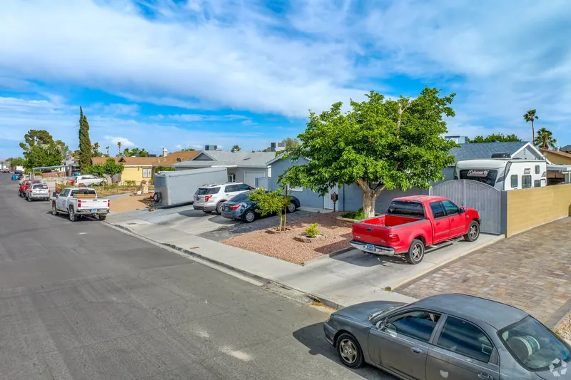
It's a mixed area: single-family homes from the 1970s through the 1990s sit next to duplexes, condo complexes and apartments, with a handful of new custom homes on larger, older lots. Zillow's September 2026 index puts the typical home near $352,000, and US-95, Rancho Drive and the Strip are all within about 15–20 minutes.
In short
One of the shortest drives to downtown and the Strip from the northwest, at a starter-home price.
Older lots, no-HOA streets and the occasional RV-parking gem.
Character
Character & history
This part of the valley grew in the 1970s and 1980s as Las Vegas spread northwest along Rancho Drive and Lake Mead Boulevard. NeighborhoodScout describes most homes as built between 1970 and 1999, with some newer infill since 2000; RE/MAX's neighborhood profile notes many two- and three-bedroom homes built around 1985.
Owners and renters are roughly evenly mixed. Some streets have older homes on larger lots with no HOA, which appeals to buyers who want RV parking, a workshop or room for a pool. Bus routes on Rancho, Lake Mead, Jones and Rainbow are frequent, and Rancho Drive gives a direct run toward downtown.
Housing
Housing ranges from small condos and townhomes, often under $250,000, to typical single-story homes in the $330,000–$420,000 range and occasional newer custom homes on half-acre lots. Zillow's September 2026 tiers run from about $255,000 at the bottom third to about $417,000 at the top third.
Because the area mixes condos and apartments with single-family homes, read HOA documents carefully for condos and check rental ratios if you plan to use a VA loan on a condo.
- 1970s–90s single-family homes
- Condos and townhomes
- Duplexes and small multifamily
- Scattered new custom homes on older lots
Ranch and Spanish-influenced stucco; some newer contemporary infill
Mostly 5,000–7,000 sq ft; some older lots of 0.5 acre or more
Mostly 1970–1999, some 2000s infill
Crime data
NeighborhoodScout reports haven’t been pulled for this area yet, so this guide doesn’t show a crime index for it.
This guide doesn’t rate neighborhoods as safe or unsafe. Look up reported crime for the exact address, and a radius around it, with LVMPD Open Data crime maps (Las Vegas Metropolitan Police, which covers the City of Las Vegas and unincorporated Clark County). Then drive the street at different times of day. Home values, housing types and school ratings are covered in the Housing and Schools sections.
Schools
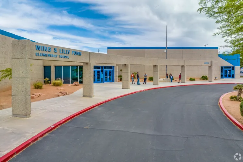
Public schools below are the ones zoned at the middle of the area; boundaries split many neighborhoods, so check the exact address.
| Name | Level | Type | Grades | GreatSchools | Niche | NSPF | Notes |
|---|---|---|---|---|---|---|---|
| Bertha Ronzone Elementary School | ES | Public (zoned) | PK, K-5 | 6/10 | C | 2 | Zoned at the area center (CCSD zone lookup, Nov. 14, 2026) |
| J Harold Brinley Middle School | MS | Public (zoned) | 6-8 | 4/10 | C | 2 | Zoned at the area center (CCSD zone lookup, Nov. 14, 2026) |
| Cimarron Memorial High School | HS | Public (zoned) | 9-12 | 3/10 | C+ | 3 | Zoned at the area center (CCSD zone lookup, Nov. 14, 2026) |
| Doral Academy Fire Mesa | K-8 | Charter | K-8 | 9/10 | A- | ||
| Founders Academy Las Vegas | K-12 | Charter | K-12 | not rated | B- | ||
| Nevada State High School Summerlin | HS | Charter | 11-12 | 10/10 | A | Dual-enrollment high school (grades 11–12) | |
| Liberty Baptist Academy | Private | Private | K-12 | not rated | A | ||
| Word Of Life Christian Academy | Private | Private | PK, K-12 | not rated | A |
School ratings as dated in the source guide. Confirm current zoning at zoneinfo.ccsd.net before you write an offer. Ratings change.
Parks and trails
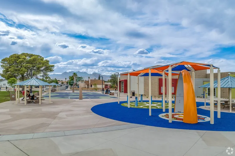
- Neighborhood playgrounds and pocket parks: Shade structures and play areas within walking distance of many streets.
- Lorenzi Park: Large city park with a lake, sports fields and the Nevada State Museum, about 10 minutes southeast.
- W. Wayne Bunker Family Park: Sports fields and paths about 10 minutes north.
- Durango Hills Golf Club and YMCA: City golf course and full-service YMCA about 10 minutes northwest.
Shopping and dining
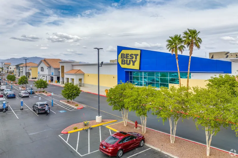
- Rancho Drive and Lake Mead Boulevard: Big-box stores, grocery chains and fast-casual dining.
- Rainbow Boulevard corridor: Neighborhood centers, coffee and local restaurants.
- Downtown Las Vegas: About 15 minutes southeast via Rancho Drive or US-95.
Commutes
Off-peak drive estimates (OSRM routing on OpenStreetMap) from the middle of the area; add 10–25 minutes at rush hour. Creech times assume the US-95 route to the main gate.
| Destination | Minutes (off-peak) | Miles |
|---|---|---|
| Nellis AFB (main gate) | 25 | 13.1 |
| Creech AFB (main gate) | 45 | 38.9 |
| The Strip (Flamingo Rd) | 17 | 8.5 |
| Harry Reid Intl. Airport (T1) | 23 | 12.1 |
From the approximate area center of Michael Way, it is about 20 minutes (10.6 miles) to the Haven Street approach (Locations North) before dawn, and about 26 minutes as a +30% afternoon planning estimate. Times are OSRM / OpenStreetMap free-flow routing on November 14, 2026, from the approximate area center to the Haven Street approach (36.0923, −115.1668), not to Terminal 1. Early mornings (about 4–6 AM) typically match free-flow. The afternoon figure is a +30% planning estimate, not live traffic. Times exclude parking and badge time. Test-drive your report time.
For military buyers
Michael Way is about 25 minutes from the Nellis main gate and about 45 minutes from Creech off-peak.
At typical prices in the mid-$300Ks, an O-3's BAH covers a VA loan payment here. For condos, confirm the complex is VA-approved before you write an offer. For older homes, budget for roof, HVAC and plumbing checks.
Eric can introduce you to VA-experienced lenders if you want that help. You may use any lender you choose. He is a real estate agent, not a lender.
Pros
- Central location and quick freeway access
- Entry prices well below the valley median
- Some no-HOA homes with big lots
- Frequent bus service
Watch-outs
- Mix of owners and renters
- Zoned schools rate low to middling
- Older homes and condos need careful inspection
- Quality varies street by street
Boundaries and notes
Jurisdiction: City of Las Vegas ZIP codes referenced in the guide: 89108, 89107 Source guide updated 2026-11-14.
Copper dot: approximate center of the area. Navy dots: Nellis AFB (northeast), the Strip and Harry Reid Intl. Airport. For orientation only; not a boundary, HOA or school-zone map.
Sources
- NeighborhoodScout — Michael Way public profile (checked Nov 14, 2026)
- RE/MAX — Michael Way neighborhood guide
- City of Las Vegas — Parks and facilities
- Zillow Home Value Index (Sep 2026)
- CCSD attendance-zone lookup (checked Nov 14, 2026)
- GreatSchools / Niche ratings (checked Nov 13, 2026)
- Nevada Report Card / NSPF star ratings 2025–26
- OSRM routing on OpenStreetMap data
- DTMO BAH calculator (2026 rates)
Verify before you rely on a number
- There was no VA write-up for Michael Way; content is from public profiles, Zillow and CCSD data.
- Boundaries are approximate (Zillow/RE/MAX neighborhood label).
- No NeighborhoodScout reports purchased for this area.
FAQ
For the long version, with commute, HOA, school and crime-data questions answered in depth, read the full Michael Way guide-blog: Michael Way: questions answered.
What is Michael Way like?
Michael Way is a close-in northwest Las Vegas neighborhood named for the residential street that runs through it, roughly between Rancho Drive and Rainbow Boulevard around Lake Mead Boulevard and Smoke Ranch Road in ZIP 89108.
What city and ZIP codes is Michael Way in?
Jurisdiction: City of Las Vegas. ZIP codes referenced in this guide: 89108, 89107.
What is a typical home value in Michael Way?
About $352K as of September 2026, from Zillow's home value index (-2.2% over 12 months). Confirm current asking prices; this is not an appraisal.
How long is the drive from Michael Way to Nellis AFB?
About 25 minutes off-peak, 13.1 miles, from the area center to the main gate (OSRM routing, Nov. 13, 2026). Allow 25% to 50% more at rush hour and test-drive your report time.
How long is the drive from Michael Way to Creech AFB?
About 45 minutes off-peak, 38.9 miles, from the area center to the main gate (OSRM routing, Nov. 13, 2026). Allow more at rush hour and test-drive your report time.
How long is the drive from Michael Way to the Haven Street approach (Locations North)?
About 20 minutes (10.6 miles) before dawn and about 26 minutes as an afternoon planning estimate, excluding parking and badge time.
Which public schools are zoned for Michael Way?
Zoned schools named in this guide include Bertha Ronzone Elementary School, J Harold Brinley Middle School, Cimarron Memorial High School. Zones change, so confirm the exact address at zoneinfo.ccsd.net.
Are there HOA fees or SID/LID assessments in Michael Way?
Some streets have older homes on larger lots with no HOA, which appeals to buyers who want RV parking, a workshop or room for a pool. Some no-HOA homes with big lots. Ask for the HOA resale package and any SID/LID payoff in writing.
Is there new construction in Michael Way?
Michael Way is a largely built-out neighborhood, and no active new-home community was found in or right next to it.
What is the crime index for Michael Way, and where can I check crime data?
This guide doesn't show a NeighborhoodScout crime index for this area yet. For the exact address, use LVMPD Open Data crime maps (opendata-lvmpd.hub.arcgis.com), and look at a radius around the home.
Can I use a VA loan to buy here?
Eligible buyers can use a VA loan on resale and new homes here; condos and townhomes need VA project approval. You may use any lender you choose. Eric is a real estate agent, not a lender, and nothing on this site is a loan offer or a commitment of credit.
How do I talk with a local agent?
Book a free 30-minute call with Eric “Nuke” Hudson, or call or text 702-706-5841. He is a realtor with Keller Williams The Marketplace (NV License S.173602).
Talk with Eric
Book a free 30-minute Zoom for a neighborhood shortlist, a BAH and VA-loan reality check, and a buying plan. Eric will tell you when an area is not the right fit.
- Call or text 702-706-5841
- Email vegasrealtor@eric-hudson.com
- PCS to Vegas game plan session — recommended starting point for military and veteran moves
- Las Vegas relocation strategy session
- Keller Williams The Marketplace
- NV License S.173602
- 10000 W. Charleston Blvd., Suite 130, Las Vegas, NV 89135
- Broker: JC Melvin
You may use any lender you choose. Eric is a real estate agent, not a lender, and nothing on this site is a loan offer or a commitment of credit.
The illustrated guide is also on FlipLink: https://go.fliplink.me/view/michael-way-neighborhood-guide.
Photos from the area
Agent-level VA loan basics for military and veteran buyers: VA loan basics.