
Download the PDF guide
You can read this guide on the page. No form is required. If you want a PDF copy to keep or share, the download asks for your name and email.
Read the full Southwest Las Vegas guide-blog
Straight answers to the questions people ask most: the drive to Nellis and Creech, home values, HOA and SID/LID fees, schools, crime-data lookups, summer bills, and Eric’s own take.
Where it is
This outline shows how Southwest Las Vegas sits in the Las Vegas Valley. This outline is approximate.
OpenStreetMap / Nominatim lookup, retrieved 2026-11-13 Map data © OpenStreetMap contributors. The outline is for orientation only and is not a survey or legal boundary.
New Construction Nearby
| Community | Builder | Location | Home type | Price range |
|---|---|---|---|---|
| Paldona | Pulte Homes | Southwest Las Vegas, about 1 mile from the 215 Beltway, near Arroyo Market Square; sales at 8744 Indigo Springs Road, Las Vegas, NV 89139 | Two- and three-story single-family homes | From $562,990 |
Builder info changes often; ask Eric for current incentives.
Newer homes, big regional parks and fast 215/I-15 access to the Strip and airport.
Southwest valley · Unincorporated Clark County · Newer suburbs
At a glance
| Fact | Detail |
|---|---|
| Typical home value | $468K |
| 1-year change | -3.3% |
| NeighborhoodScout crime index | 36–64 (higher = lower reported crime; source: NeighborhoodScout, reports dated Nov. 14, 2026) |
| Drive to Nellis / Creech | 39 / 69 min |
| Drive to Strip / airport | 21 / 22 min |
Overview
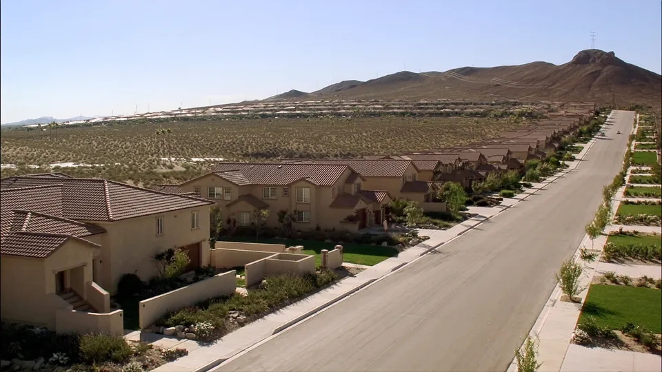
The southwest valley is where Las Vegas grew fastest in the 2000s, and it is still filling in. Two names anchor this guide: Mountain’s Edge, a roughly 2,500-acre master plan wrapped around a 120-acre county regional park and the Exploration Peak hiking area, and Rhodes Ranch, an older guard-gated golf community with its own amenity center and water park.
Around them are dozens of newer subdivisions, the Durango Casino & Resort and the UnCommons mixed-use district. Homes are generally newer than in the central valley, lots are compact, and the 215 Beltway puts the Strip, airport and Summerlin within about 20 minutes off-peak.
The trade-off for military buyers is distance: Nellis is a cross-valley drive and Creech is more than an hour away.
In short
Exploration Peak gives Mountain’s Edge something rare in a suburb: a summit hike from your front door.
You trade a longer base commute for newer homes, parks and quick access to the Strip and airport.
A strong pick for civilian commuters and dual-income military households who want new construction near the 215.
Character
Character & history
Twenty-five years ago most of this corner of the valley was open desert along Blue Diamond Road. Mountain’s Edge broke ground in the early 2000s under Focus Property Group, with neighborhoods organized around parks and a trail network rather than a golf course. Exploration Peak Park — about 80 acres, 24 of them developed — climbs to a 2,846-foot summit with valley-wide views, and Mountain’s Edge Regional Park adds sports fields, an equestrian area and dog parks.
Rhodes Ranch, west of Durango Drive near Warm Springs, opened in the late 1990s as a guard-gated community built around an 18-hole golf course. Its staffed gates, R Club amenity center and resort-style pools give it a self-contained feel that is unusual at its price point.
Since 2020 the area has added a new layer: the Durango Casino & Resort (opened December 2023) and the UnCommons office-retail district near the 215 and Durango, plus a steady pipeline of new subdivisions to the south and west. Expect construction traffic on the edges for several more years.
Housing
Zillow’s typical value for ZIP 89178 (the core of Mountain’s Edge) was about $468,000 at the end of September 2026, down 3.3% from a year earlier — close to the valley’s single-family median. Rhodes Ranch and gated pockets trade higher; townhomes and older entry plans trade lower.
Most homes are two-story production plans built from the late 1990s to today on compact lots, with single-story plans commanding a premium. New construction is still available on the southern and western edges.
- Two-story production homes
- Single-story plans
- Townhomes & condos
- Guard-gated golf homes (Rhodes Ranch)
- New construction on the edges
Stucco-and-tile Spanish/Mediterranean in 2000s tracts; desert contemporary and modern farmhouse in newer phases
Often 3,000–5,500 sq ft; larger lots are uncommon outside Rhodes Ranch and a few custom pockets
Mostly 1997–present; Mountain’s Edge largely 2003–2015, newer phases ongoing
Crime data
NeighborhoodScout crime index: 36–64 (higher = lower reported crime; source: NeighborhoodScout, reports dated Nov. 14, 2026).
Three NeighborhoodScout reports cover the southwest: Mountain’s Edge, Mountain’s Edge East and Rhodes Ranch. They paint a consistent picture of an owner-occupied suburb with zoned-school quality above the national midpoint (62–71 on NeighborhoodScout’s 100-point index).
NeighborhoodScout crime indexes are above the valley average — Mountain’s Edge and Mountain’s Edge East sit in the 60s (NeighborhoodScout: lower reported crime than about 60% of U.S. neighborhoods) — while Rhodes Ranch reads lower because the polygon includes busier commercial edges. Appreciation was about 8% a year over the past five years and essentially flat over the past 12 months.
These figures are NeighborhoodScout’s, summarized from its sub-neighborhood reports dated Nov. 14, 2026 (neighborhoodscout.com). The crime index runs 1–100 against U.S. neighborhoods, and a higher number means lower reported crime. It is not our rating of any street.
This guide doesn’t rate neighborhoods as safe or unsafe. Look up reported crime for the exact address, and a radius around it, with LVMPD Open Data crime maps (Las Vegas Metropolitan Police, which covers the City of Las Vegas and unincorporated Clark County). Then drive the street at different times of day. Home values, housing types and school ratings are covered in the Housing and Schools sections.
Schools
Southwest Las Vegas is split between the Sierra Vista and Desert Oasis high school zones, with Gunderson, Canarelli and Faiss middle schools. The table shows the CCSD zones covering the largest share of the mapped area, plus notable charters and the Southwest CTA magnet.
| Name | Level | Type | Grades | GreatSchools | Niche | NSPF | Notes |
|---|---|---|---|---|---|---|---|
| Judith D Steele Elementary School | ES | Public (zoned) | PK, K–5 | 6/10 | B+ | 2 | CCSD zone covers ~18% of the mapped area |
| Don and Dee Snyder Elementary School | ES | Public (zoned) | PK, K–5 | 7/10 | B | 2 | CCSD zone covers ~16% of the mapped area |
| Carolyn S Reedom Elementary School | ES | Public (zoned) | PK, K–5 | 7/10 | B+ | 2 | CCSD zone covers ~15% of the mapped area |
| Tyrone Thompson Elementary School | ES | Public (zoned) | PK, K–5 | 8/10 | A- | 4 | CCSD zone covers ~13% of the mapped area |
| Gunderson Barry and June Middle School | MS | Public (zoned) | 6–8 | 9/10 | A- | 5 | CCSD zone covers ~41% of the mapped area |
| Lawrence & Heidi Canarelli Middle School | MS | Public (zoned) | 6–8 | 6/10 | B+ | 3 | CCSD zone covers ~30% of the mapped area |
| Wilbur & Theresa Faiss Middle School | MS | Public (zoned) | 6–8 | 7/10 | B+ | 3 | CCSD zone covers ~24% of the mapped area |
| Sierra Vista High School | HS | Public (zoned) | 9–12 | 4/10 | B | 4 | CCSD zone covers ~60% of the mapped area |
| Desert Oasis High School | HS | Public (zoned) | 9–12 | 5/10 | B | 4 | CCSD zone covers ~37% of the mapped area |
| Southwest Career & Technical Academy | HS | Magnet (CTA) | 9–12 | 9/10 | A | 5 | Application-based career & technical magnet |
| Doral Academy – Cactus Campus | K-8 | Charter | K–8 | 9/10 | A- | Public charter; lottery | |
| Legacy Traditional School – Southwest Las Vegas | K-8 | Charter | K–8 | 8/10 | A- | Public charter; lottery |
School ratings as dated in the source guide. Confirm current zoning at zoneinfo.ccsd.net before you write an offer. Ratings change.
Parks and trails
- Exploration Peak Park: Summit trail to a 2,846-ft peak, playgrounds, splash pad and pickleball; maintained by the Mountain’s Edge master association.
- Mountain’s Edge Regional Park: Clark County park with sports fields, an equestrian area and dog parks.
- Rhodes Ranch Golf Club & R Club: 18-hole course plus the community’s pools and fitness center (residents).
- Desert Tortoise Conservation Center & Red Rock Canyon: Desert open space and the Red Rock scenic drive within about 20–30 minutes.
Shopping and dining
- Durango Casino & Resort: Opened in 2023 at Durango and the 215; restaurants and a food hall.
- The UnCommons: Mixed-use office, dining and retail district near the 215.
- Blue Diamond Rd. & Rainbow Blvd. centers: Grocery-anchored centers (Albertsons, Smith’s, Vons, Walmart Supercenter).
- South Point & Town Square: Bowling, movies, an equestrian center and outdoor shopping within 15 minutes.
Healthcare
Fort Apache Rd.
15–20 min
on Nellis AFB
Commutes
Off-peak driving estimates (OSRM/OpenStreetMap routing) from the area center to the Nellis AFB main gate (Las Vegas Blvd. N.), the Creech AFB main gate (Indian Springs), the center Strip (Flamingo Rd.) and Harry Reid International Terminal 1, calculated Nov. 13, 2026. Allow 25–50% more at rush hour, and test-drive your report-time commute before you write an offer.
| Destination | Minutes (off-peak) | Miles |
|---|---|---|
| Nellis AFB | 39 | 26.4 |
| Creech AFB | 69 | 53.0 |
| The Strip | 21 | 12.9 |
| Harry Reid Airport | 22 | 12.9 |
The Locations North commuter guide gives these early-morning drives to the Haven Street approach for the two parts of this southwest guide — Mountain’s Edge / the southwest: about 19 minutes (11.5 miles) early morning, about 25 minutes afternoon planning estimate; Rhodes Ranch: about 18 minutes (10.6 miles) early morning, about 23 minutes afternoon planning estimate. Times are from the Locations North commuter guide: OSRM / OpenStreetMap free-flow routing on November 14, 2026, from the area center to the Haven Street approach (36.0923, −115.1668), not to Terminal 1. Early mornings (about 4–6 AM) typically match free-flow. The afternoon figure is a +30% planning estimate, not live traffic. Times exclude parking and badge time. Test-drive your report time.
For military buyers
For Nellis, plan on about 39 minutes off-peak via the 215 and I-15 — longer at rush hour, when the I-15 corridor near the Spaghetti Bowl backs up. Creech is roughly 69 minutes away, which makes the southwest a hard sell for Creech-assigned members. It works best for civilian commuters headed to the Strip, the airport or the southwest employment corridor.
Typical values near $470,000 mean a zero-down VA payment runs several hundred dollars above O-3 BAH before taxes, insurance and HOA. Newer homes often inspect cleanly; still budget for any SID payoff and confirm HOA rules on RVs and short-term rentals.
| label | value | note |
|---|---|---|
| Est. P&I on the typical value | $3,148/mo | Dated Nov. 12, 2026 example. Taxes, insurance, HOA, and SID/LID are excluded. Confirm the current mortgage rate and loan costs with a lender you choose. |
| Gap vs. O-3 BAH | +$766/mo | Positive = out of pocket before taxes, insurance & HOA |
| Price where P&I ≈ O-3 BAH | $354K |
Get VA pre-approved early; use any lender you choose.
Ask for HOA resale package, master + sub-association dues and any SID/LID payoff.
Confirm the zoned school for the exact address at zoneinfo.ccsd.net.
Drive the commute at your report time before writing an offer.
For condos/townhomes, confirm VA project approval.
Eric can introduce you to VA-experienced lenders if you want that help. You may use any lender you choose. He is a real estate agent, not a lender.
Pros
- Newer housing than most of the central valley
- Exploration Peak and large regional parks
- Quick 215/I-15 access to the Strip and airport
- Rhodes Ranch offers guard-gated golf at mid-market prices
- Growing dining around Durango and the UnCommons
Watch-outs
- Cross-valley drive to Nellis; over an hour to Creech
- Compact lots in many subdivisions
- Ongoing construction on the southern and western edges
- Master + sub-HOA dues and possible SIDs
- Fewer mature trees than older areas
Boundaries and notes
Jurisdiction: Unincorporated Clark County (Enterprise and Spring Valley townships) with Las Vegas mailing addresses; Clark County Commission and Metro police. ZIP codes referenced in the guide: 89113, 89118, 89139, 89141, 89148, 89178, 89179 Source guide updated 2026-11-13.
Southwest Las Vegas: Mountain's Edge & Rhodes Ranch boundary (shaded) used for this guide’s data. For orientation only — not a legal, HOA or school-zone map.
Sources
- Clark County Parks — Exploration Peak Park
- Mountain’s Edge Master Association — amenities
- Nevada Real Estate Group — Mountain’s Edge 2026 guide
- Clark County Comprehensive Planning — Mountain’s Edge
- Zillow Research, ZHVI data files (Sep 30, 2026)
- NeighborhoodScout sub-neighborhood reports (Nov. 2026)
- CCSD attendance zones (InfoLocator ArcGIS service), queried Nov. 13, 2026
- GreatSchools and Niche school profiles, checked Nov. 13, 2026
- Nevada Dept. of Education NSPF 2025-26 star ratings (Sep 15, 2026)
- Las Vegas REALTORS® October 2026 market report (Nov. 6, 2026)
- DTMO BAH calculator (2026, MHA NV212)
- Freddie Mac PMMS (Nov. 12, 2026)
Verify before you rely on a number
- ZIP 89178 is a proxy for Mountain’s Edge and blends in nearby subdivisions.
- Mountain’s Edge master dues ($135/quarter) are from a 2026 brokerage blog; confirm with the association.
- Mountain’s Edge Regional Park acreage varies by source (120 vs. 220 acres); confirm with Clark County Parks.
FAQ
For the long version, with commute, HOA, school and crime-data questions answered in depth, read the full Southwest Las Vegas guide-blog: Southwest Las Vegas: questions answered.
What is Southwest Las Vegas: Mountain's Edge & Rhodes Ranch like?
The southwest valley is where Las Vegas grew fastest in the 2000s, and it is still filling in. Two names anchor this guide: Mountain’s Edge, a roughly 2,500-acre master plan wrapped around a 120-acre county regional park and the Exploration Peak hiking area, and Rhodes Ranch, an older guard-gated golf community with its own amenity center and water park.
What city and ZIP codes is Southwest Las Vegas in?
Jurisdiction: Unincorporated Clark County (Enterprise and Spring Valley townships) with Las Vegas mailing addresses; Clark County Commission and Metro police. ZIP codes referenced in this guide: 89113, 89118, 89139, 89141, 89148, 89178, 89179.
What is a typical home value in Southwest Las Vegas?
About $468K as of September 2026, from Zillow's home value index (-3.3% over 12 months). Confirm current asking prices; this is not an appraisal.
How long is the drive from Southwest Las Vegas to Nellis AFB?
About 39 minutes off-peak, 26.4 miles, from the area center to the main gate (OSRM routing, Nov. 13, 2026). Allow 25% to 50% more at rush hour and test-drive your report time.
How long is the drive from Southwest Las Vegas to Creech AFB?
About 69 minutes off-peak, 53.0 miles, from the area center to the main gate (OSRM routing, Nov. 13, 2026). Allow more at rush hour and test-drive your report time.
Which public schools are zoned for Southwest Las Vegas?
Zoned schools named in this guide include Judith D Steele Elementary School, Don and Dee Snyder Elementary School, Carolyn S Reedom Elementary School, Tyrone Thompson Elementary School, Gunderson Barry and June Middle School. Zones change, so confirm the exact address at zoneinfo.ccsd.net.
Are there HOA fees or SID/LID assessments in Southwest Las Vegas?
Master + sub-HOA dues and possible SIDs. Ask for the HOA resale package and any SID/LID payoff in writing.
Is there new construction in Southwest Las Vegas?
Yes. Communities selling in or near the area when checked on Nov. 16, 2026 include Paldona (Pulte Homes). Prices and incentives change often.
What parks and outdoor spots are near Southwest Las Vegas?
Exploration Peak Park, Mountain’s Edge Regional Park, Rhodes Ranch Golf Club & R Club, Desert Tortoise Conservation Center & Red Rock Canyon.
What is the crime index for Southwest Las Vegas, and where can I check crime data?
NeighborhoodScout crime index: 36–64 (higher = lower reported crime; source: NeighborhoodScout (neighborhoodscout.com), reports dated Nov. 14, 2026). That is NeighborhoodScout's figure, not a rating from this guide. For the exact address, use LVMPD Open Data crime maps (opendata-lvmpd.hub.arcgis.com), and look at a radius around the home.
Can I use a VA loan to buy here?
Eligible buyers can use a VA loan on resale and new homes here; condos and townhomes need VA project approval. You may use any lender you choose. Eric is a real estate agent, not a lender, and nothing on this site is a loan offer or a commitment of credit.
How do I talk with a local agent?
Book a free 30-minute call with Eric “Nuke” Hudson, or call or text 702-706-5841. He is a realtor with Keller Williams The Marketplace (NV License S.173602).
Talk with Eric
Book a free 30-minute Zoom for a neighborhood shortlist, a BAH and VA-loan reality check, and a buying plan. Eric will tell you when an area is not the right fit.
- Call or text 702-706-5841
- Email vegasrealtor@eric-hudson.com
- PCS to Vegas game plan session — recommended starting point for military and veteran moves
- Las Vegas relocation strategy session
- Keller Williams The Marketplace
- NV License S.173602
- 10000 W. Charleston Blvd., Suite 130, Las Vegas, NV 89135
- Broker: JC Melvin
You may use any lender you choose. Eric is a real estate agent, not a lender, and nothing on this site is a loan offer or a commitment of credit.
The illustrated guide is also on FlipLink: https://go.fliplink.me/view/southwest-neighborhood-guide.
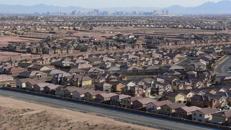
Photos from the area
Related videos
3,671 views
2,507 views
View counts as of November 16, 2026, from YouTube. Watch more on youtube.com/@movingtonevada.
Agent-level VA loan basics for military and veteran buyers: VA loan basics.